Day 1
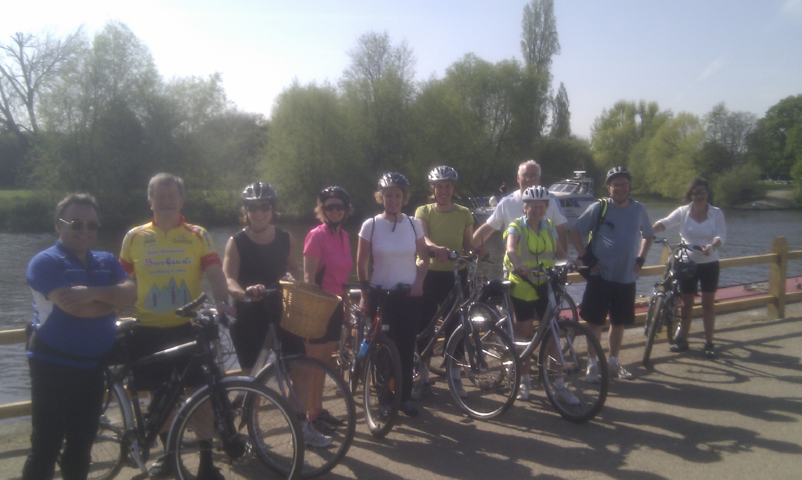
Seven of us (Angela, John, me, Danny, Steve, Simon and Stephanie) set off from Weybridge at 7am after first dipping our front wheels in the Thames. This is a tradition from the Coast to Coast route and although we would be cycling from the Thames to the Seine, we thought we could do the same thing.
One objective of day 1 was to reach Newhaven using only the Sustrans National Cycle Route network. For this reason we set off along route 4, which runs from London to Fishguard in Wales. We didn’t go that far though, just using it to get to Chertsey where we switched onto route 223, a newly established route that leads through Woking to Guildford.
We arrived at Woking Leisure Centre at 8:15, already 15 minutes behind schedule, where we met with the rest of the group, Ian and Helen on their tandem, and Barbara, Sandra and Lynda. The twelve of us then set off at a cracking pace to Guildford. Our first encounter with cows was at Riverside Park just before we reached Guildford. This was where we first discovered the effects of Sandra’s bright purple cycling jacket. Disturbed from their morning breakfast of fresh grass the herd of cattle bolted straight across our path very nearly taking out Sandra in the process.
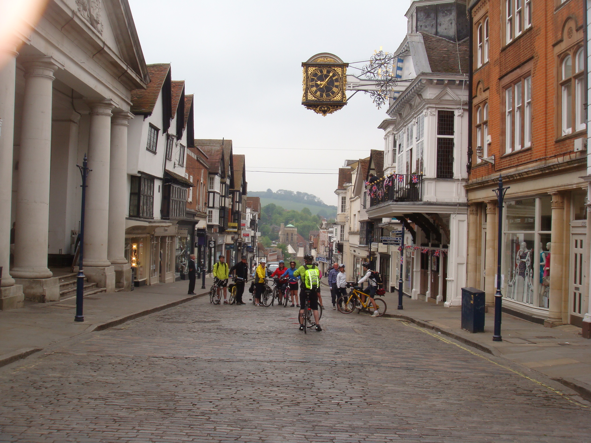
Reaching Guildford High Street, which was largely deserted, we stopped for a photo opportunity under the clock, while the man at the Guildhall was busy putting out the bunting for the big wedding. Despite our fears that the forecast was rain, it was starting to warm up and the sun made it’s first appearance. Our spirits were high.
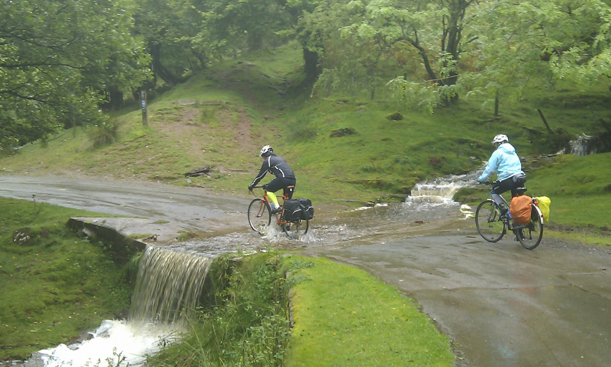
At the bottom of the High Street we reached the end of route 223 and switched on to Sustrans route 22. This took us to Shalford and the start of the old Guildford to Horsham railway line, which was axed by Mr Beeching in 1966 after 101 years of service.
In no time we were through Bramley, where the old station platform is still evident, and heading towards Cranleigh.
After a brief stop, we set off from Cranleigh, with the intention of reaching our scheduled coffee stop at Southwater by 11am. But this was when Simon had our first (and only) puncture. The path from Cranleigh is a bit rougher and the flint stones are not cycle friendly.
Simon was using very lightweight race tyres and a flint chipping made a quarter inch gash in the wall of his tyre. The deflation was explosive. Luckily we had a ‘boot’ which we used to reinforce the tyre wall from the inside, allowing Simon to get enough air pressure to carry on riding – at least temporarily. However, he didn’t want to risk another puncture and so he and Steve decided to take the road route to Shoreham.
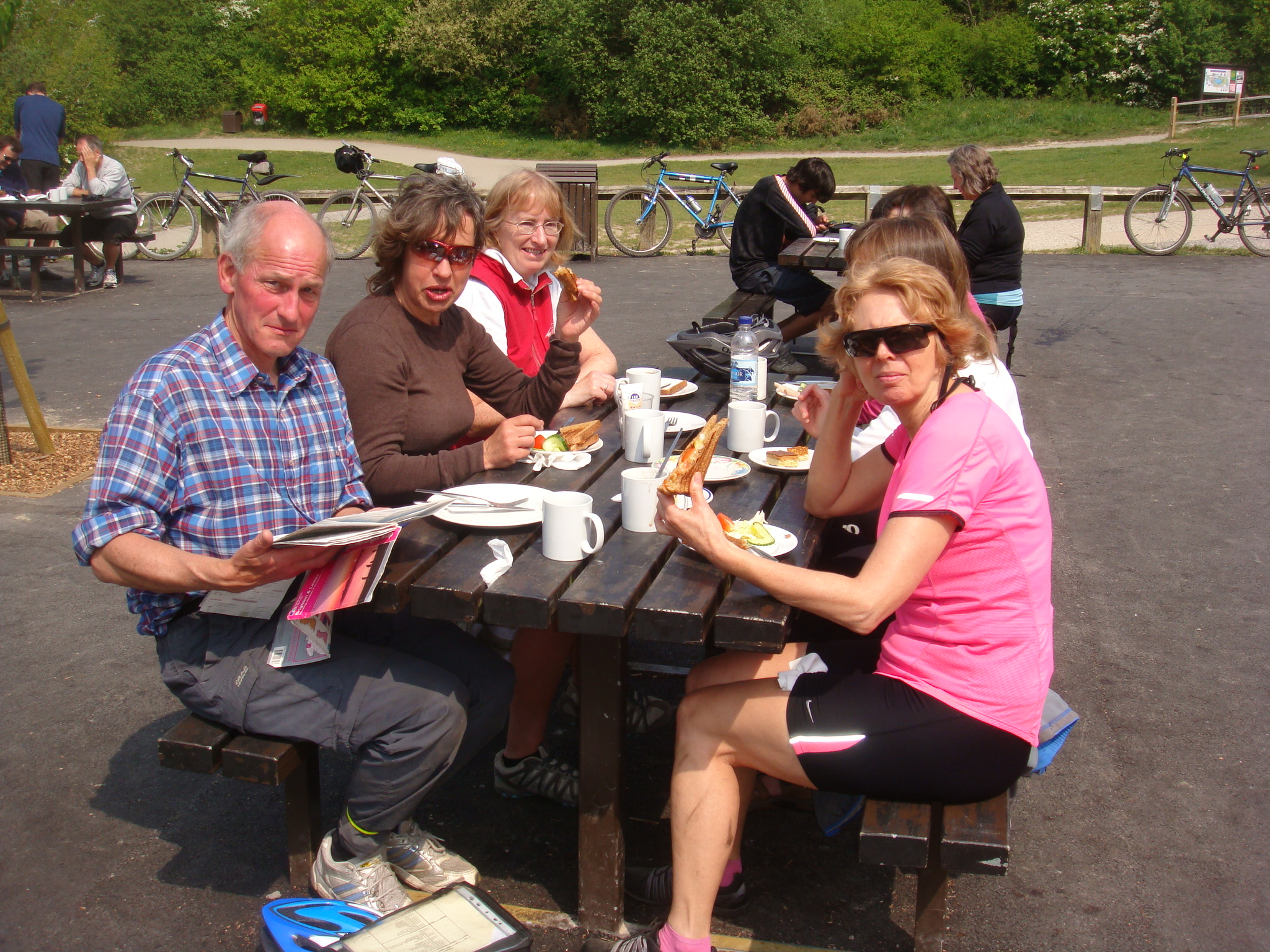
Now down to 10 people our next stop was Southwater Country Park. The sun was shining brightly by now and the enormous cakes served in the cafe were just the energy boost we needed. There was no TV at the cafe but we got word from the ladies serving there that the wedding dress was gorgeous.
The next section of the route along the railway path was particularly rough. Ian and Helen felt it would be too much for their tandem and elected to take an alternative road route. Barbara, Sandra and Lynda took off with them as well, preferring the few extra miles to the rough and bumpy path.
At this point we were now three groups all converging on Shoreham with a rendezvous at a pub which we vaguely thought was on the outskirts of Shoreham and was called something like The Windmill. In the back of my mind I worried about all the things that could go wrong with each group and how we were going to pull everyone together again.
My worries were unfounded. The pub turned out to be named The Amsterdam (close enough!) and we all arrived within about 10 minutes of each other, including Simon and Steve who must have sprinted all the way after getting their puncture repaired. It was now 2:30pm, we’d lost time all along the way, but with only 25 miles left to do, we had plenty of time to reach Newhaven.
Avoiding Shoreham High Street we zigzagged through the back streets of the town towards the sea. This was street party territory. Everyone was enjoying themselves and waving as we passed. We quickly reached the long spit that forms Shoreham harbour. Here we turned east toward Hove and Brighton and straight into a strong headwind.
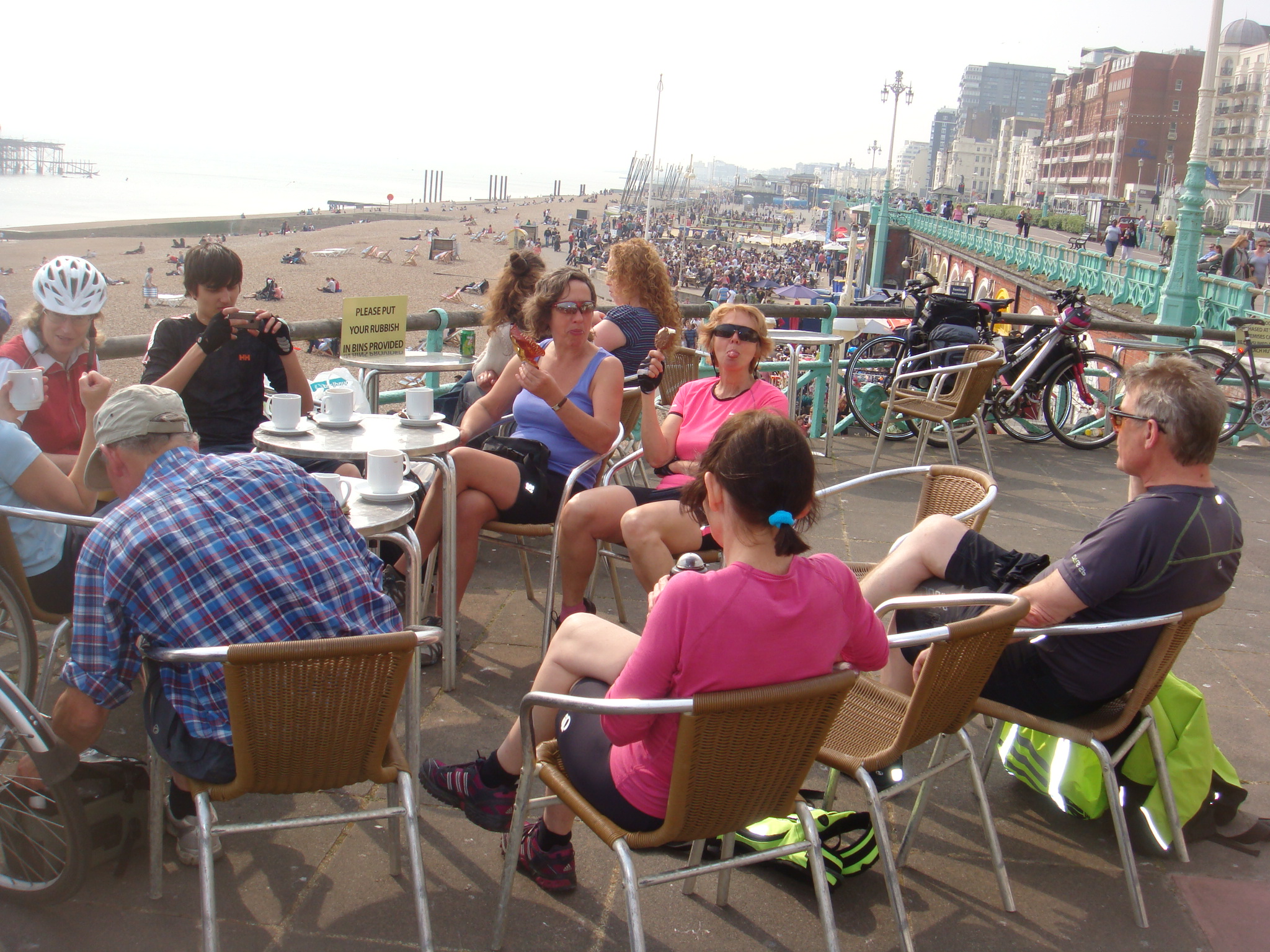
We reached Brighton by 4pm. The streets were full of people in Royal Wedding Bank Holiday party mood. We stopped here for an hour while Simon found a bike shop and got some new tyres. While Simon was getting fixed up we all sat on the promenade with ice creams and watched the world that is Brighton on a Bank Holiday go by. Sandra entertained us all by teaching pigeons how to eat chips. One developed an interesting technique of throwing the chip over the back of it’s head – not very effective as the next pigeon would steal it before it could turn around.
Leaving Brighton at 5pm, we passed the marina and started to climb up towards Rottingdean. The wind strengthened as we gained altitude.
With fully loaded packs and 60 miles under our belts the headwind and the proximity of heavy trucks and busses made the going very tough. We were all finding it hard and there was plenty of climbing to do to reach the top of the ridge where the road then swooped down into Newhaven.
6:30pm, the first day over. 70 miles completed (except for the Woking lot who had ‘only’ done 60 miles). We checked in to our respective hotels, the Premier Inn which was standard and the Newhaven Lodge which was delightful. Both were fully accommodating of our bicycles and gave us a friendly welcome.
The last member of our group Chris was due to join us here and was already checked in at the Premier Inn when we arrived.
As we all sat down to dinner there was a flash of lightning, a clap of thunder and the heavens opened. We’d dodged the weather today, but with our group now numbering 13, were we going to continue to have luck on our side?